
|
|
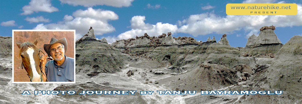
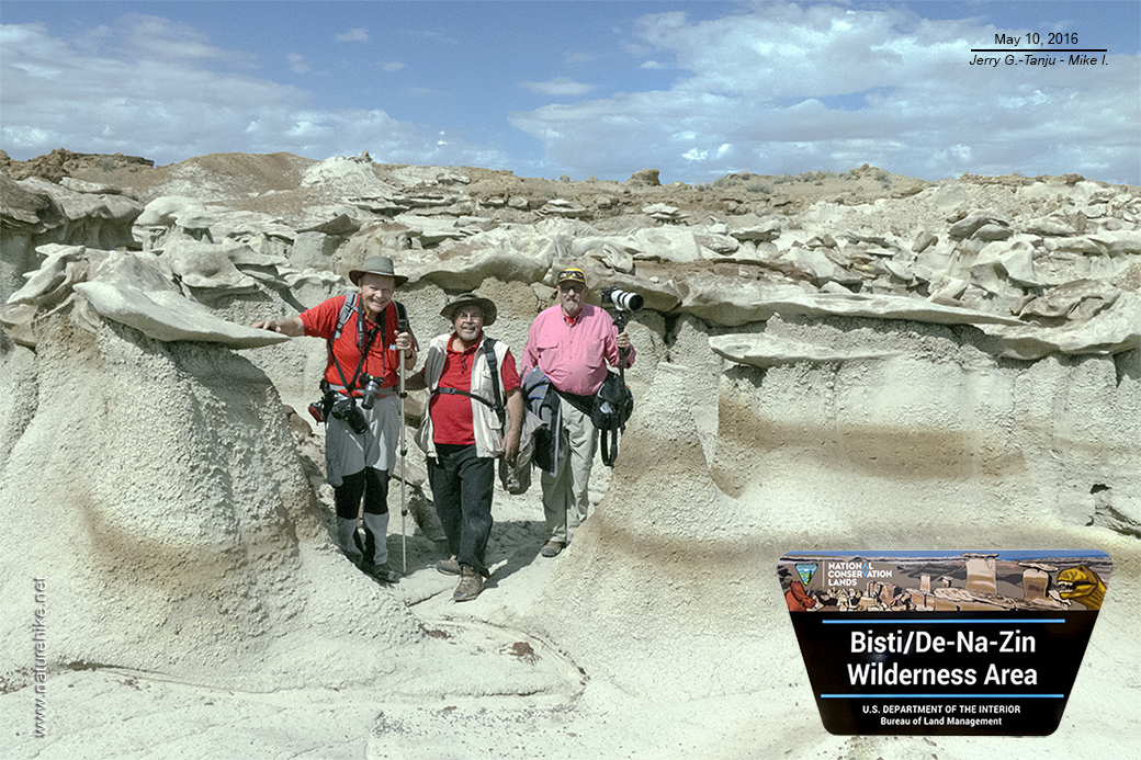
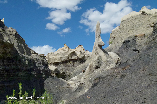
Like an other planet ! 'Bisti/De-Na-Zin' Wilderness (BISTI BAD LAND) is little visited and largely unknown, but is an amazingly scenic and colorful area! It is very Interesting place for desert hiking, exploring, and photography. Also it is the most accessible and varied area of badlands and hoodoos in the San Juan Basin... with miles of weird and wonderful eroded sandstone formations, of every color and shape imaginable! I visit BISTI with two of my photographer friends on May 2016 and here are some of my photographs and some brief descriptions with them. I present this in the hopes that others will see the awesomeness of this interesting land. |
| 
|
| This amazing 45,000-acre (roughly 60 square miles) wilderness area located in San Juan County in New Mexico. USA. Established in 1984, the Wilderness is a desolate area of steeply eroded badlands managed by the 'Bureau of Land Management', with the exception of three parcels of private 'Navajo land' within its boundaries. |
|
| In Navajo language 'Bisti'(Bis-tie) means 'a large area of shale hills', and 'De-Na-Zin' (Deh-nah-zin) takes its name from the Navajo words for 'cranes'. I have visited 'Bisti' with two of my photographer friends on May 2016. |
| 
|
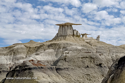
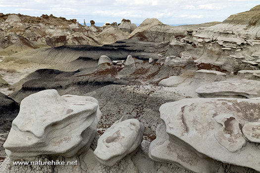
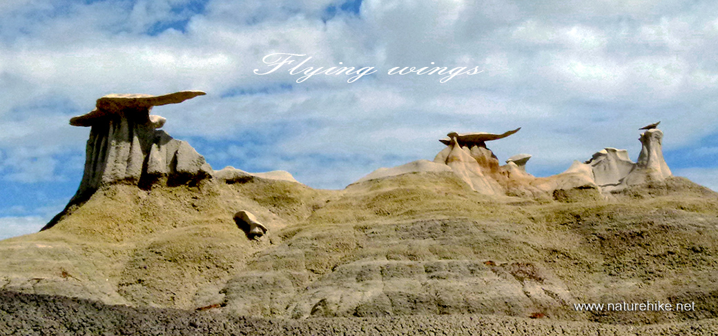
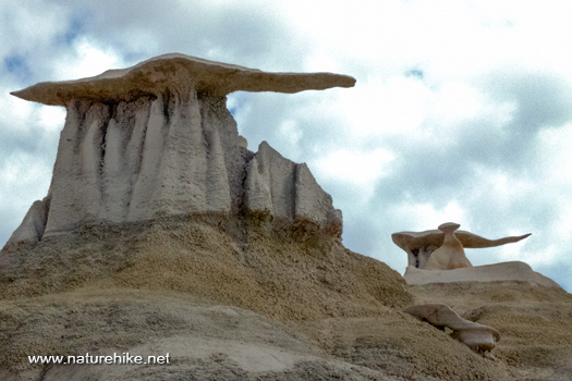
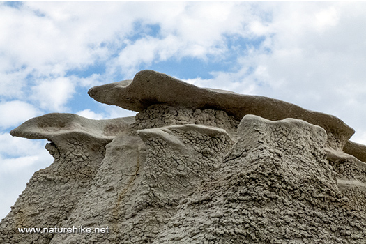
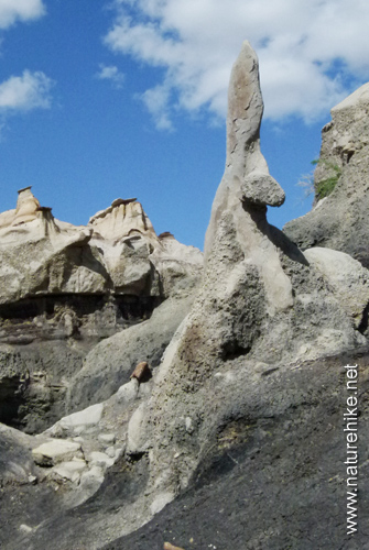
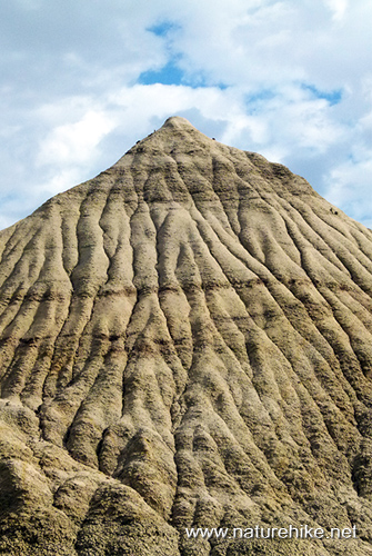
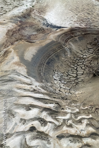
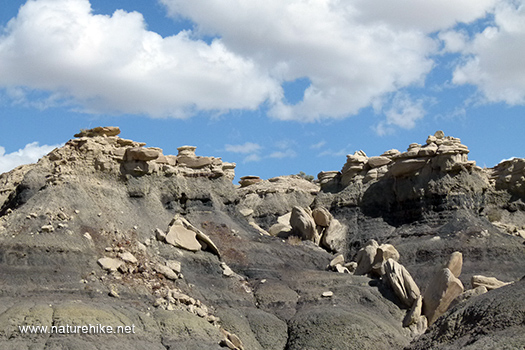
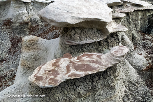
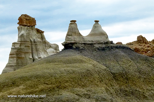
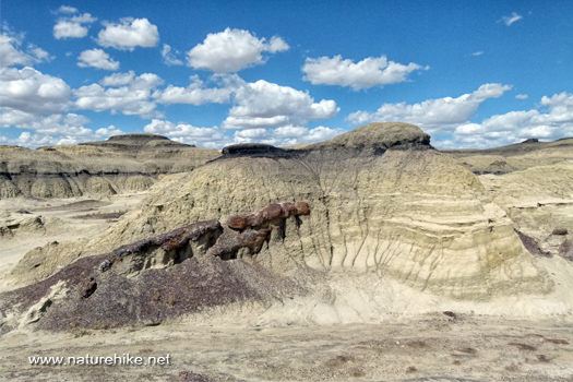
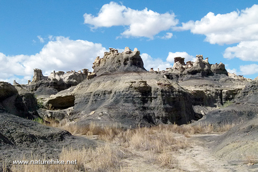
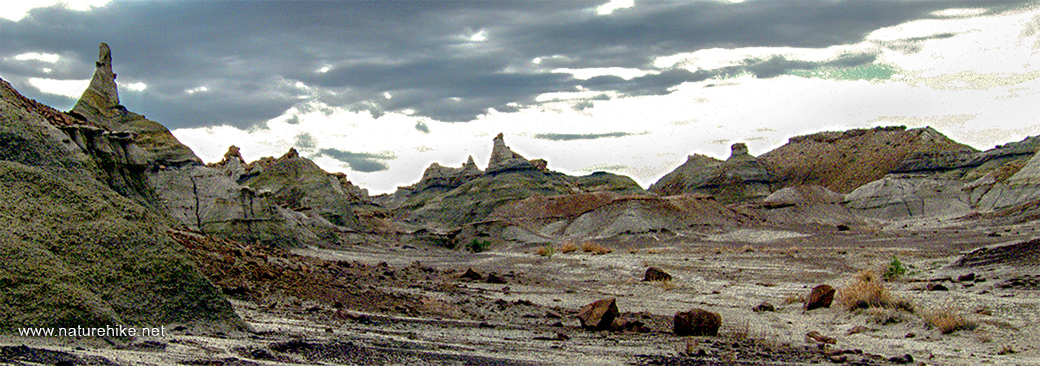
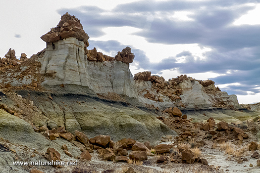
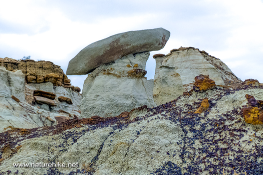
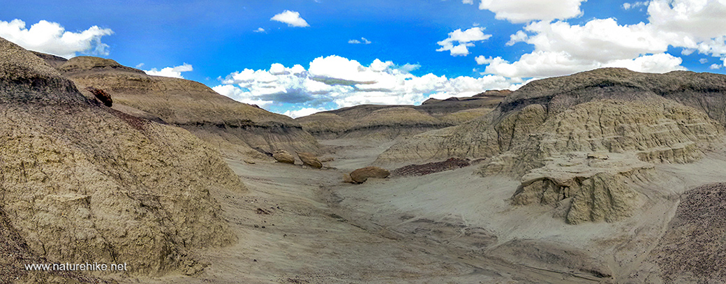
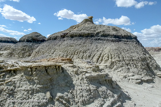
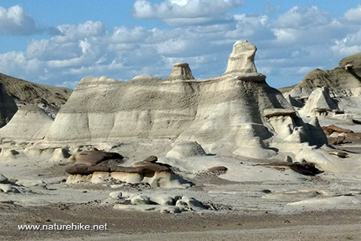
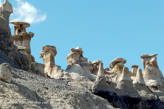
| Bisti/De-Na-Zin's unusual scenery found in the 'Four Corners Region'. In this extraordinary place; time and natural elements have etched a fantasy world of strange rock formations made of inter bedded sandstone, shale, mudstone, coal, and silt. The weathering of the sandstone forms hoodoos as weathered rock in the form of pinnacles, spires, cap rocks, and other unusual forms. I love these 'flying wings'. |
| 
| 
|
| Humans have occupied the area almost continuously since 10,000 BC. It is part of the prehistoric Great North Road, used to connect major 'Chacoan Anasazi' (a Navajo word meaning 'ancient ones')sites in the 'San Juan Basin'. |
|
|
There are no signposts pointing the way to Bisti from any nearby towns, but the usual approach route is 35 miles south along NM 371 from Farmington, the largest town
in the Four Corners region - this heads due south through wide open prairie land at the east edge of the great 'Navajo Indian Reservation', which extends for 200 miles
across into Arizona. When we were shooting here my friend Jerry was saying me that he felt like we are in another planet :) |
| 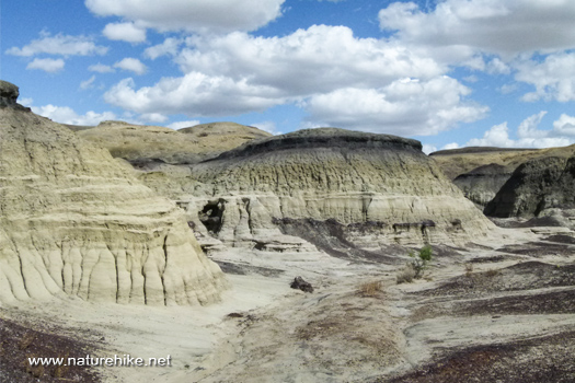 |
| This 60 square miles of remote badlands offer some of the most unusual scenery in New Mexico and a truly unforgettable area to photograph, hike and explore. |
|  |
| You
can reach some of the most astonishing landscapes with hikes of 2 to 5 miles round trip. We made 5 miles (~8.2 km) in one day. But please note, if you are not a hiker, this place is
not for you. In my opinion it is best to travel in the early morning and late afternoon before it gets dark.
|
|  |
| Visiting this area is free of charge. There is no formal entrance or visitor center. I have read that a small variety of wildlife can be found here including cottontail rabbit, coyote, badger, and prairie dog. Bird species include pinyon jay, raven, quail, dove, ferruginous hawk, prairie falcon, and golden eagle. Lizard, snake, tarantula, and scorpion also live here. But I didn't see any. |
|
| Elevation averages around 6,300 ft (~1920 meters) and the most striking scenery is in the southern two-thirds of the area. Backpacking, horse packing and primitive camping is allowed but campfires are forbidden. " Motorized vehicles are not permitted in the wilderness. Btw; there are no trails or established campsites. So, chances are you won't encounter a soul here. |
|  |
| This magnificent place is very popular with photographers and, I heard that for some reason, well known to German tourists. |
|
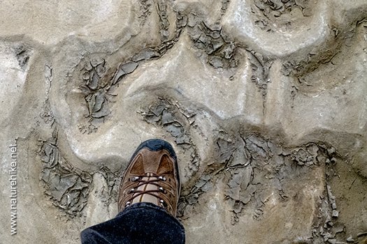
| The Bisti is a remarkable product of a series of geologic events, and it is an even more remarkable snapshot of the final days of the 200 million year reign of the dinosaurs. So, The Bisti became a graveyard for dinosaurs, and it became a window on the world in which they lived. It is now one of the potential locations for testing theories for the passing of the dinosaurs. |
|  |
| These strange fossils represent another world, one as alien to us today as the surface of another planet. |
|  |
| I brought you to the end now and you saw some of my photographs from this wonderful place, and some brief descriptions of it. I hope you enjoyed viewing my photographs and hope that my experiences on this area can be helpful for you in planning your trip to Bisti Badlands. |
|  |
| All Rights Reserved. © 2008-2025 NATUREHIKE.NET. This site was created by Tanju Bayramoglu and launched in 2008 and updated on March 2025. Powered from Phoenix,USA. The majority of the text used in this presentation has been taken from various sources on the Internet. All images appearing in this site are the exclusive property of www.NATUREHIKE.net and in any form may not be reproduced, copied, stored, or manipulated without the written permission of Tanju Bayramoglu. |
|